Takht-e Soleyman: A City Full of Treasure + Legend
- Attractions, Iran World Heritage Sites
- ASSASSINS, Suleiman, Takht-e Soleyman, The Prison of Solomon, The Throne of King Solomon, Unesco, WHS, Zendan-e-Soleyman, Zoroastrian
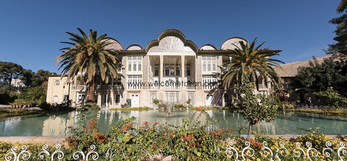
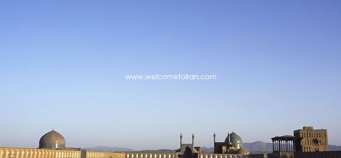
Takht-e Soleyman Located 45 km northeast of Takab, it is an ancient site that has been building holy structures around it since 1600 years ago. The fifth Bahram Vassan Sassanid built the site as a city and 70 years after it, Ghobad first expanded its buildings until it reached its peak at the time of Khosrow Anoshirvan Sassanid.
The discovery of the signs and remnants of human presence from the first millennium BC to the 11th century AH in this 12-hectare area reveals the mysteries of the city to experts. For a long time, humans used this collection as a habitation, and religious beliefs about it illustrate the importance of the city throughout history.
Takht-e Soleyman is believed to be the birthplace of Zoroaster, and the construction of Azargoshnasb Fire Temple in this area as the most respected Zoroastrian temple during the Sassanian period can be a confirmation of this belief. This temple was important in the socio-political life of the Sassanids, and its immortal flames were not extinguished for seven centuries, as a symbol of the authority of Zoroastrianism.
Some people believe that the city has been the site of the holy grail of Christ, which he drinks on its last night of life. This cup is famous for the Grail Cup, but no trace of it has been seen on Takht-e Soleyman.
The folk belief of this city is considered to be the location of Solomon’s prophet, and points out that extraterrestrial forces, based on the orders of Hazrat Solomon, built massive structures that human beings cannot afford to create.
This collection was registered in 1316 with the number 318 in the National Iranian Book List. The name of this work is also on the UNESCO World Heritage List.

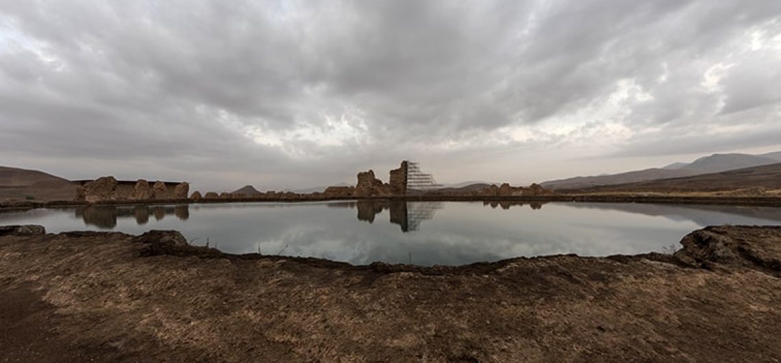
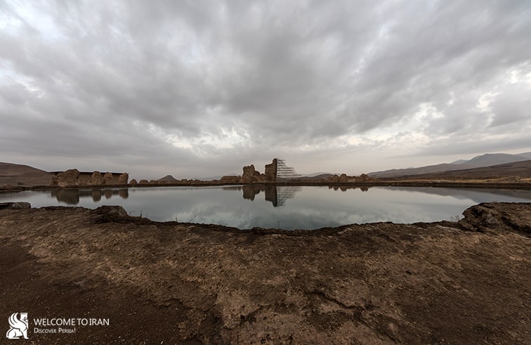
Takht-e Soleyman; A City Full of Treasure in the Depths of the Lake
The myths of this mysterious lake are not one in two. There are many stories in many language circles that reveal this phenomenon much more complex than a typical lake. The most famous legend is the existence of countless treasures in the depths of the lake. Endless treasures that have been thrown to the lake throughout history. Stories that have led many to the lake, but it should be noted that access to such treasures does not look so safe.
This legendary city (Takht-e Soleyman) underneath the lake contains many objects with signs of them. It is interesting to know that in none of the historical periods there is no finding of these treasures

Ring of Solomon the Prophet
The most controversial treasure that may exist on the lake floor is Solomon’s ring. According to folk beliefs, the whole collection of Takht-e Soleyman was made by super powers who Solomon commanded them. He had a ring that took all his power from it. There is a story telling that the Devil was able to reach the ring and put it into the lake to rely on the throne of Solomon. After this incident, Satan sat down on the throne of Solomon. Some believe that Suleiman the prophet never achieved this ring, but there are other interpretations that says that Solomon was able to remove the ring from the stomach of a fish that had eaten it and defeat Satan.

Treasure Search on Takht-e Soleyman
Efforts have been made to discover this treasure and answer the questions that are there, but the depth of the lake and its deposits are an important obstacle for explorers. It’s as if this treasure trove has a very strong bodyguard, so that nobody has been informed of its secret until this time. Even European explorers came to the lake, but no diving could penetrate more than 31 meters deep into the lake. Water pressure in the lake and heavy and heavy liquids are major obstacles to this.
For the first time, German divers came into the lake. According to their observations, which were later published, a lake was found at a depth of 112 meters. Also, 10 water channels were discovered on the edge of the lake, but due to their large water deposits and their limitation of vision, they could not discover a particular effect in the depths of the water.

Death, Gift of the Soleyman Lake
Around Takht-e Soleyman, there are several “Banned Swimming” themes, which can indicate that this beautiful lake is also equally scary. In addition to this tranquility, Takht-e Soleyman only serves the without experience guests with death; guests who like to lay their hands on the water of the lake, but do not report the anger within it. This lake brutally swallows every creature that enters it, deep down. Next to this lake, you can see the tomb of some of our compatriots who have gone to the lake and never returned. Of course, the lake returned only a corpse where it was buried there.
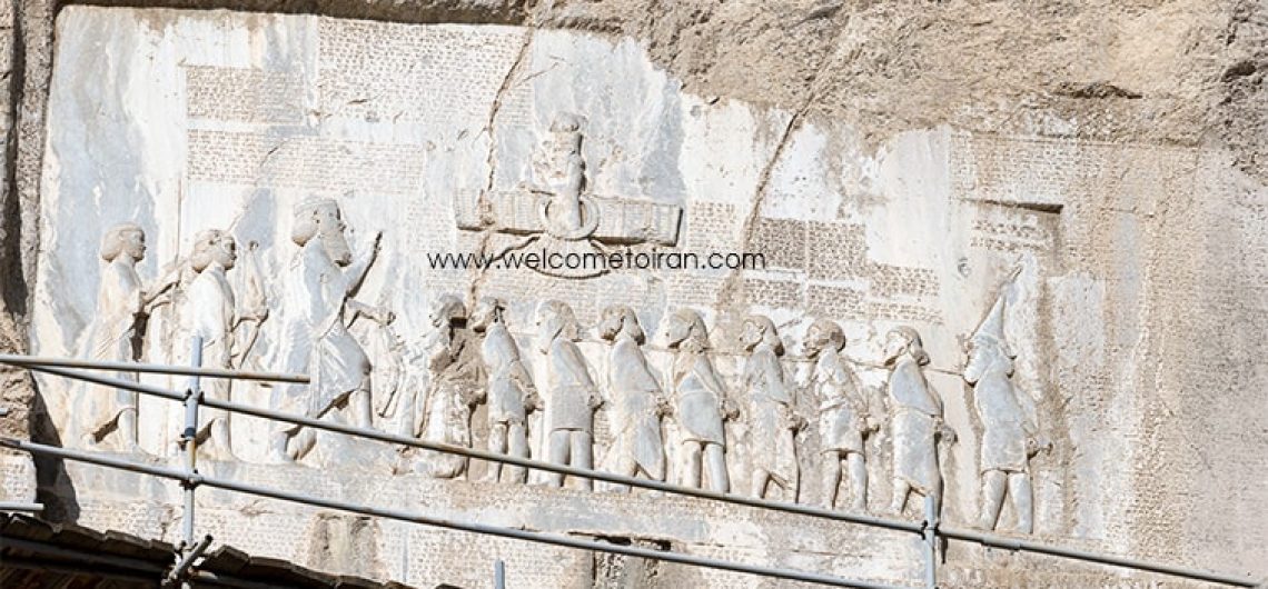
The site also has many important symbolic relationships, being associated with beliefs much older than Zoroastrianism as well as with significant biblical figures and legends.

Zendan-e Soleyman, a Place to Punish Rebellious Demon
An ancient volcano, known as Zendan-e-Soleyman (meaning ‘The Prison of Solomon’) is located about 3km to the west of the site. According to folk legend, this beautiful mountain area is known as Solomon’s Prison or Demon Prison, and they believe that Solomon had imprisoned the demons who disobeyed his command. This name has been placed on this mountain in accordance with the attribution of the site to Prophet Solomon.