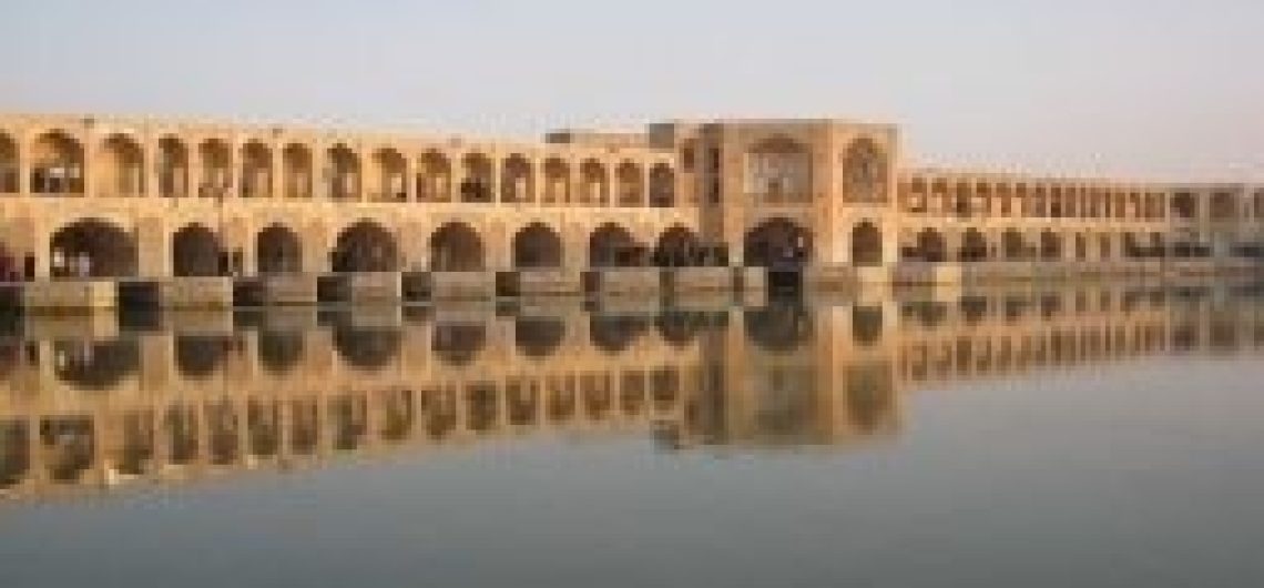
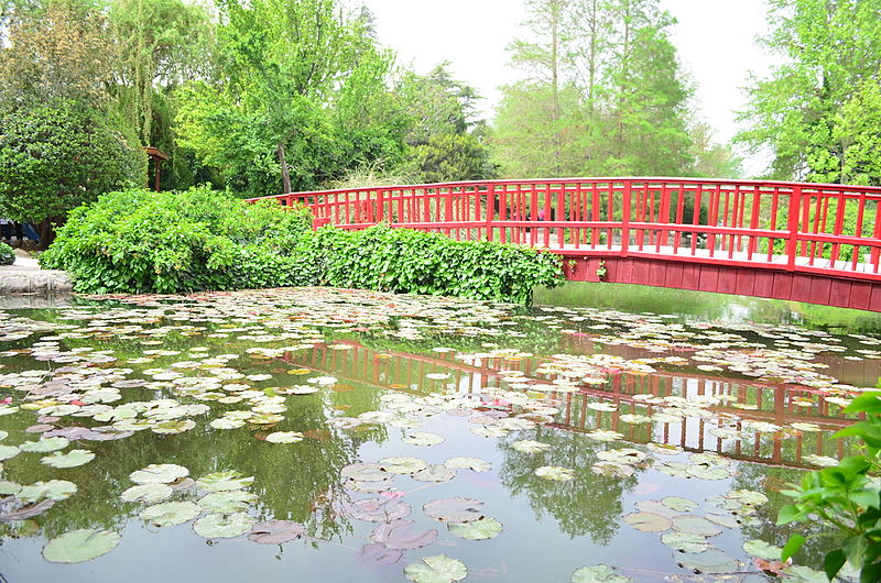
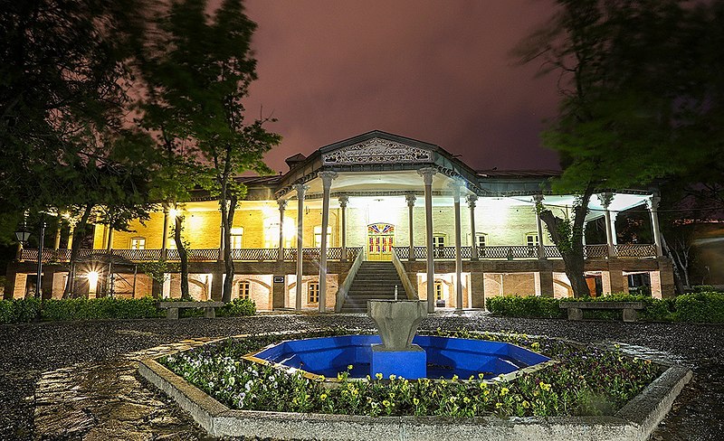
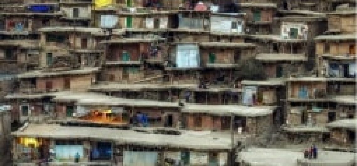
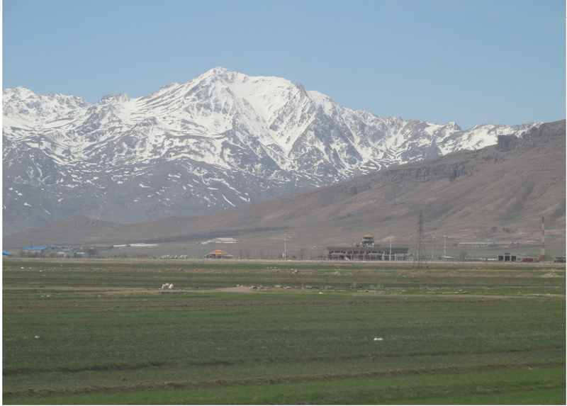
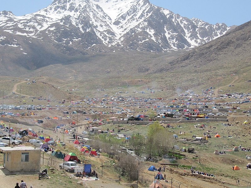
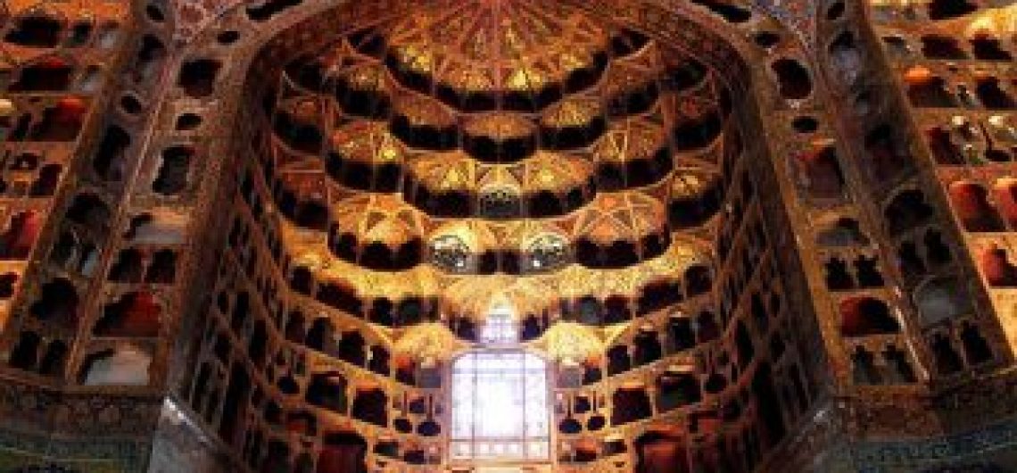
Isfahān is the capital of Isfahān Province in Iran, located about 340 km (2111 Imiles) south of Tehrän. It flourished from 1050 to 1722, particularly in the 16th and 17th centuries in the Safavid era, when it became the capital of Persia for the second time in palaces, mosques, and minarets. This led to the Persian proverb “Esfahän nesf-e jahān” (Isfahān the half of the world). Even today, the city retains much of its past glory. It is famous for its PersianIslamic architecture, with many beautiful boulevards and bridges. The Naqsh-e Jahan Square in Isfahān is one of the largest city squares in the world. It has been registered by UNESCO as a World Heritage Site. The city also has a wide variety of historic monuments and is known for the paintings, history and architecture. Isfal, a city center is also the 5th largest shopping mall in the world and combruk traditional Isfahani and modern architecture. The Zayandeh-Roud River flows though the city: Isfahān is located at the foothills of Zagros mountain range. The nearest mountain is Mo Soffeh (Kouh-e Soffeh) which is situated just south of Isfahān. Due to lack geological obstacles before 90 km (56 miles), northern cool wind blows city. Situated at 1.590 meters above sea level on the eastern side of the Zagros Mountains, Isfahlin has an arid climate. Despite its altitude, Isfahan remains hot during the summer and the temperature does not exceed 35 °C. However, Mohr Jan with low humidity and moderate temperatures at night, the climate can be very pleasant. During the winter. Days are mild, while nights can be very cold. Isfahan province encompasses various sects today. The majority of the people in the province are Persian speakers, but Bakhtiari Lurs, Georgians, Armenians, Qashqais and Persian Jews also reside in the province.
Isfahān is the capital of Isfahān Province in Iran, located about 340 km (2111 Imiles) south of Tehrän. It flourished from 1050 to 1722, particularly in the 16th and 17th centuries in the Safavid era, when it became the capital of Persia for the second time in palaces, mosques, and minarets. This led to the Persian proverb “Esfahän nesf-e jahān” (Isfahān the half of the world). Even today, the city retains much of its past glory. It is famous for its PersianIslamic architecture, with many beautiful boulevards and bridges. The Naqsh-e Jahan Square in Isfahān is one of the largest city squares in the world. It has been registered by UNESCO as a World Heritage Site. The city also has a wide variety of historic monuments and is known for the paintings, history and architecture. Isfal, a city center is also the 5th largest shopping mall in the world and combruk traditional Isfahani and modern architecture.
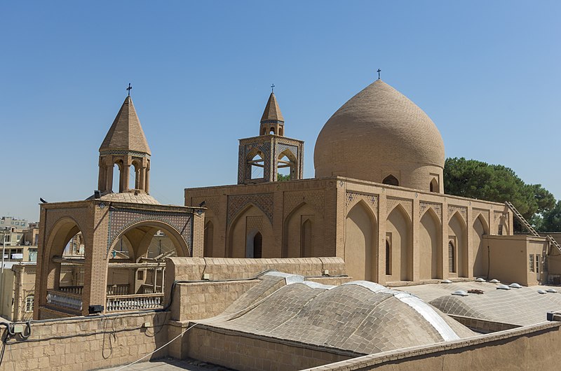
Ispahan Vank Cathedral
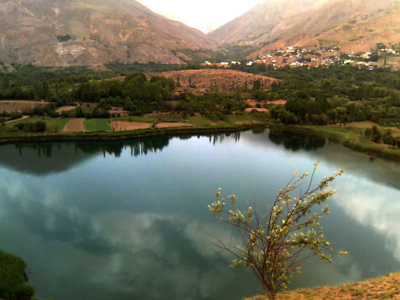
The Zayandeh-Roud River flows though the city: Isfahān is located at the foothills of Zagros mountain range. The nearest mountain is Mo Soffeh (Kouh-e Soffeh) which is situated just south of Isfahān. Due to lack geological obstacles before 90 km (56 miles), northern cool wind blows city. Situated at 1.590 meters above sea level on the eastern side of the Zagros Mountains, Isfahlin has an arid climate. Despite its altitude, Isfahan remains hot during the summer and the temperature does not exceed 35 °C. However, Mohr Jan with low humidity and moderate temperatures at night, the climate can be very pleasant. During the winter. Days are mild, while nights can be very cold.
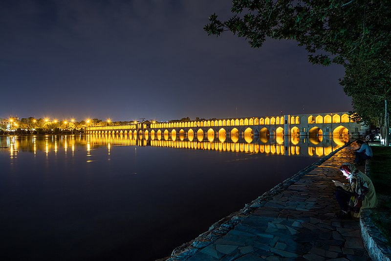
The Allahverdi Khan Bridge in night
Isfahan province encompasses various sects today. The majority of the people in the province are Persian speakers, but Bakhtiari Lurs, Georgians, Armenians, Qashqais and Persian Jews also reside in the province. The official language of the province is Persian, though different ethnic groups and tribes abide by their own language such as Judeo-Persian, Armenian, Georgian, Qashqai Turkic or Bakhtiari Larish. Isfahan province is noted for its reputed personalities such as writers, poets and other eminent ligures who have been born and brought up or have lived in this territory.
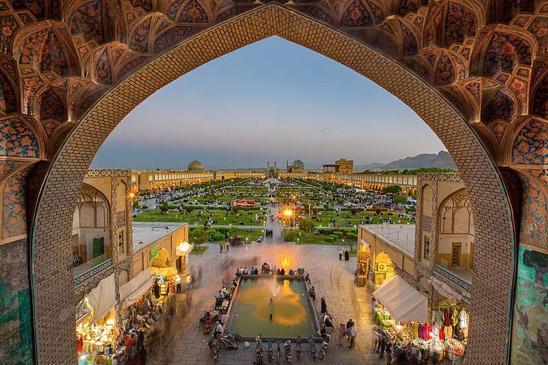
Naghshejahan
Reference: Cultural Heritage, Handicrafts & Tourism Organization of Iran, Iran Travel guide. Iran: 2018
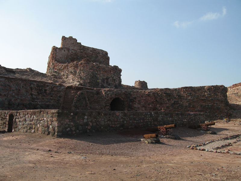
Hormozgān Province is one of the 31 provinces of Iran. It is in the south of the country, facing Oman and UAE. Its area is 70,697 km2 (27,296 sq mi), and its provincial capital is Bandar Abbas. The province has fourteen islands in the Persian Gulf and 1,000 km (620 mi) of coastline. The province is primarily mountainous, consisting of the southern tip of the Zagros Range. The province experiences a very hot and humid climate, with temperatures sometimes exceeding 120 °F (49 °C) in summers. There is very little precipitation year-round. Although Hormozgān is known to have been settled during the Achaemenid era when Nearchus passed through the region, recorded history of the main port of Hormozgān (Ban-dar-e Hormoz) begins with Ardashir I of Persia of Sassanid Empire. The province is said to have been particularly prosper tween 241 and 211 BC, but grew even furth in trade and commercial significance after the arrival of the Islamic era. Marco Polo visited the port of Bandar Abbas in 1272 and 1293. He reported widespread trading in Persian jewelry, ivory and silk of Indochina, and pearls from Bahrain in the Bāzārs of the port of Hormuz. In 1497 Europeans landed in the region for the first time, headed by Vasco da Gama. In 1508 the Portuguese, led by Afonso de Albuquerque invaded the area with seven warships, under the pretext of protecting their interests from Egypt and Venice. The port of Hormuz at the time was considered strategic positioned for commercial interests in the Persian Gali Ismail I who was trying to counter the Ottoman Empire to the west, was unable to save the port from the Portuguese, until Shah 15bas I was finally able to drive them out of the Persian Gulf with the aid of the British. 1 name
Hormozgān Province is one of the 31 provinces of Iran. It is in the south of the country, facing Oman and UAE. Its area is 70,697 km2 (27,296 sq mi), and its provincial capital is Bandar Abbas. The province has fourteen islands in the Persian Gulf and 1,000 km (620 mi) of coastline.
The province is primarily mountainous, consisting of the southern tip of the Zagros Range. The province experiences a very hot and humid climate, with temperatures sometimes exceeding 120 °F (49 °C) in summers. There is very little precipitation year-round.
Portuguese Castle (Hormuz)
Although Hormozgān is known to have been settled during the Achaemenid era when Nearchus passed through the region, recorded history of the main port of Hormozgān (Ban-dar-e Hormoz) begins with Ardashir I of Persia of Sassanid Empire. The province is said to have been particularly prosper tween 241 and 211 BC, but grew even furth in trade and commercial significance after the arrival of the Islamic era. Marco Polo visited the port of Bandar Abbas in 1272 and 1293. He reported widespread trading in Persian jewelry, ivory and silk of Indochina, and pearls from Bahrain in the Bāzārs of the port of Hormuz. In 1497 Europeans landed in the region for the first time, headed by Vasco da Gama. In 1508 the Portuguese, led by Afonso de Albuquerque invaded the area with seven warships, under the pretext of protecting their interests from Egypt and Venice. The port of Hormuz at the time was considered strategic positioned for commercial interests in the Persian Gali Ismail I who was trying to counter the Ottoman Empire to the west, was unable to save the port from the Portuguese, until Shah 15bas I was finally able to drive them out of the Persian Gulf with the aid of the British. 1 name of Bandar Abbas comes directly from the name of Shah Abbas I. The strategic importance of the Persian Gulf further increased after World War I with the discovery of oil in the region.
Reference: Cultural Heritage, Handicrafts & Tourism Organization of Iran, Iran Travel guide. Iran: 2018
Hamadān Province is one of the 31 provinces of Iran. Its center is Hamadān city. The province of Hamadān covers an area of 19,546 km2. The province lies in an elevated region, with the Alvand mountains, running from the north west to the south west. These are part of the Zagros mountain range of Iran. Hamadān enjoys temperate warm summers and relatively cold winters. Hamadān province is one of the most ancient part of Iran. Relics of this area confirm this fact. The contemporary Hamadān is what is left of Ecbatana and it was the Medes’ capital before they formed a union with the Persians. The poet Ferdowsi says that Ecbatana was built by King Jamshid. The structures of city are related to Diva Aku, a King of the Medes from 700 BC. According to Greek records, this was called ‘Ekbatan’ and ‘Hegmataneh’ by this King, thus transformed into a huge capital During the Parthian era, Ctesiphon became capital of Persia, and Hamadān became the summer capital and residence of the Parthian rulers. After the Parthians, the Sassanids constructed their summer palaces in Hamadān as well. In the 11th century, the Seljuks shifted their capital from Baghdad to Hamadān once again. The city of Hamadān was always at risk during the rise and fall of powers. It was completely destroyed during the Timurid invasion. But during the Safavid era the city thrived once more. In the 19th century, Hamadān surrendered to the Ottomans, but Hamadān was retaken by Nader Shah Afshari, and under the peace treaty between Iran and the Ottomans it was returned to Iran. The city of Hamadān lay on the Su Road and even in recent centuries enjoyed goc prospects in commerce and trade being on main road network in the western region of Iran. Hamadān is
Hamadān Province is one of the 31 provinces of Iran. Its center is Hamadān city. The province of Hamadān covers an area of 19,546 km2.
The province lies in an elevated region, with the Alvand mountains, running from the north west to the south west. These are part of the Zagros mountain range of Iran. Hamadān enjoys temperate warm summers and relatively cold winters.
Hamadān province is one of the most ancient part of Iran. Relics of this area confirm this fact. The contemporary Hamadān is what is left of Ecbatana and it was the Medes’ capital before they formed a union with the Persians. The poet Ferdowsi says that Ecbatana was built by King Jamshid. The structures of city are related to Diva Aku, a King of the Medes from 700 BC. According to Greek records, this was called ‘Ekbatan’ and ‘Hegmataneh’ by this King, thus transformed into a huge capital During the Parthian era, Ctesiphon became capital of Persia, and Hamadān became the summer capital and residence of the Parthian rulers. After the Parthians, the Sassanids constructed their summer palaces in Hamadān as well. In the 11th century, the Seljuks shifted their capital from Baghdad to Hamadān once again.
The city of Hamadān was always at risk during the rise and fall of powers. It was completely destroyed during the Timurid invasion. But during the Safavid era the city thrived once more. In the 19th century, Hamadān surrendered to the Ottomans, but Hamadān was retaken by Nader Shah Afshari, and under the peace treaty between Iran and the Ottomans it was returned to Iran. The city of Hamadān lay on the Su Road and even in recent centuries enjoyed goc prospects in commerce and trade being on main road network in the western region of Iran.
Hamedan
Hamadān is the hometown of many poets and cultural celebrities. The city is also said to be of the world’s oldest continuously inhabited cities. Hamadān has always been well known for handicrafts like leather, ceramic, and carpets. Iran’s Cultural Heritage Organization lists 207 sites of historical and cultural significance in the city of Hamadān alone. The following languages are speaking in Hamadān province:
Persian language: Spoken by the majority of Hamadan city and county centers, it’s Iran’s official language.
Azerbāijāni language: Most of the people living in the north and western side of Hamadān city speak Azeri as of their native language. (562 villages of province).
Lurish: Most people living in the southern of province in Malayer, Nahavand and Samen (255 villages of province-Luri and Lak) speak Lurish.
Kurdish: Most people living in the west of province. (159 villages of province) speak Kurdish.
Reference: Cultural Heritage, Handicrafts & Tourism Organization of Iran, Iran Travel guide. Iran: 2018
The province of Golestan is in the southeast of the Caspian Sea with an area of 20,380.7 square km. The center of Golestan province is Gorgan. Golestān enjoys mild and a temperate climate most of the year. Geographically, it is divided into two sections: The plains, and the mountains of Alborz range. In the eastem Alborz section, the direction of mountains faces northeast and gradually decreases in height. The highest point of the province is Shavar, with a height of 3,945 meters. Golestan province is divided into two sections, being the plain and mountainous parts, in the direction of Alborz Mountains, surrounding the shore and Caspian plain like an elevated wall. The ground slope reduces from the heights to the plains towards the Caspian Sea. In the southern and eastern plains of the Caspian Sea, influenced by the movements of earth and local winds, sandy hills have formed and a natural shallow dam has been created between the plain and the sea. In the eastern Alborz, the direction of mountains is towards the northeast and gradually reduces in height. Its southern mountains are Abar-Kouh Mountains and its highest summit being Shavar. The northern range is Shah-Kouh which confronts the plain of Gorgān like a wall. Its highest peak being Pirgard, reaching a height of 3,204 m. The historical background of this land dates 1 back to 7,000 years ago and the Kiaram Cave, located in the village of Galikesh (Farang) it dates back to the Paleolithic period. Recent research has shown that the Gorgān region has been home to pre-Aryan civilization since 6,000 years ago; the earliest works of the Neoli period have been found from the Kamarband and Hoto cave ne the acquaintance of the knitting, domesticatio goats and the polish Torang-Tappeh Hill, near Gorgan, have also shown that
The province of Golestan is in the southeast of the Caspian Sea with an area of 20,380.7 square km. The center of Golestan province is Gorgan.
Golestān enjoys mild and a temperate climate most of the year. Geographically, it is divided into two sections: The plains, and the mountains of Alborz range. In the eastem Alborz section, the direction of mountains faces northeast and gradually decreases in height. The highest point of the province is Shavar, with a height of 3,945 meters. Golestan province is divided into two sections, being the plain and mountainous parts, in the direction of Alborz Mountains, surrounding the shore and Caspian plain like an elevated wall. The ground slope reduces from the heights to the plains towards the Caspian Sea. In the southern and eastern plains of the Caspian Sea, influenced by the movements of earth and local winds, sandy hills have formed and a natural shallow dam has been created between the plain and the sea. In the eastern Alborz, the direction of mountains is towards the northeast and gradually reduces in height. Its southern mountains are Abar-Kouh Mountains and its highest summit being Shavar. The northern range is Shah-Kouh which confronts the plain of Gorgān like a wall. Its highest peak being Pirgard, reaching a height of 3,204 m.
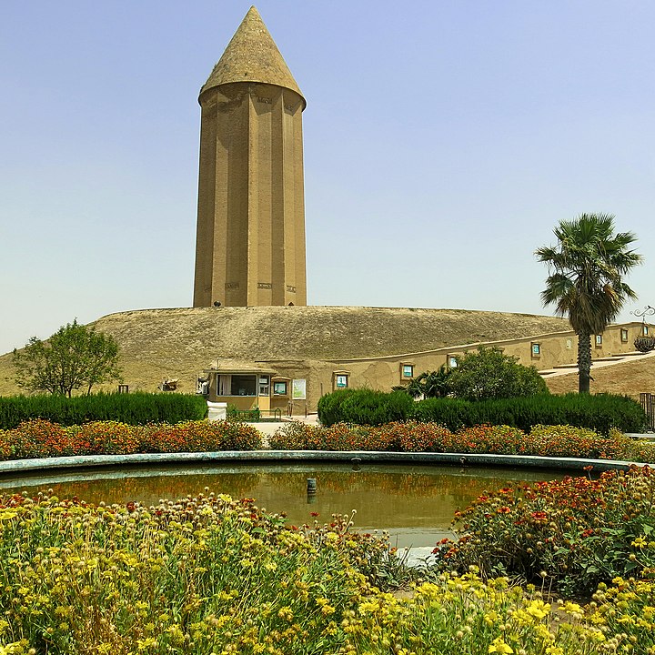
Gonbad-e_Qabus_Tower_by_Hadi_Karimi
The historical background of this land dates 1 back to 7,000 years ago and the Kiaram Cave, located in the village of Galikesh (Farang) it dates back to the Paleolithic period. Recent research has shown that the Gorgān region has been home to pre-Aryan civilization since 6,000 years ago; the earliest works of the Neoli period have been found from the Kamarband and Hoto cave ne the acquaintance of the knitting, domesticatio goats and the polish Torang-Tappeh Hill, near Gorgan, have also shown that the area has large irrigation, as much as the burned city in Sistan. The name of this land has been alternately written in the Achaemenid script, including the statue of Dariush in BiSotoun as Varganeh, in Pahlavi scripts as Gurkan.The Varg word in the language of Tabari means the wolf.
Golestān
The history of human settlements in the territory of Gorgan dates to a millennium BC. The evidences of the ancient city of Jorjan are near the current city of Gorgan. This was one of the important cities of Iran, located on the Silk Road. The Gorgan of today was known as Astar- Abad, One of the Baluch, Turks, Afqans and Armenians also reside in this area, and have preserved their traditions and rituals.
The Turkmens reside in the north of the province, a plain called Turkmen Sahra. From the 15th century, these formerly nomadic people have lived in this area, the main cities of which are Gonbad-e Kavus and Bandar Torkaman. Turkmens are Muslim and follow the Hanafi school of Sunni interpretation. They are a sizable minority at cities such as Gorgān, Ali Abad, Kalaleh and many of eastern townships. Turkmens are totally Sunni in their makeup.
Reference: Cultural Heritage, Handicrafts & Tourism Organization of Iran, Iran Travel guide. Iran: 2018
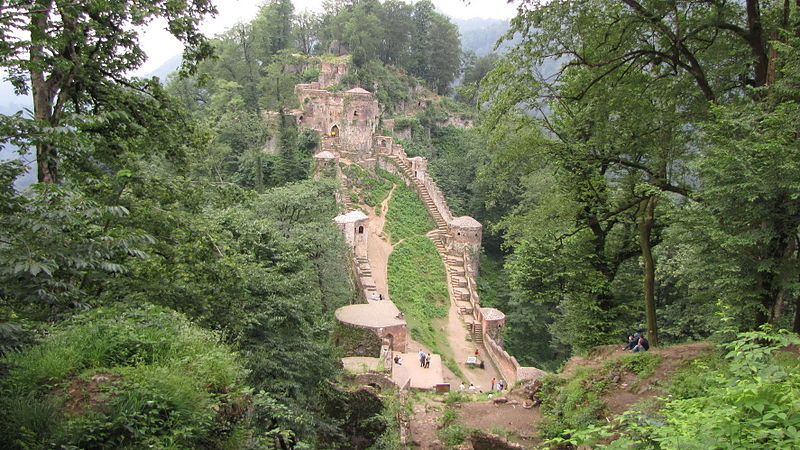
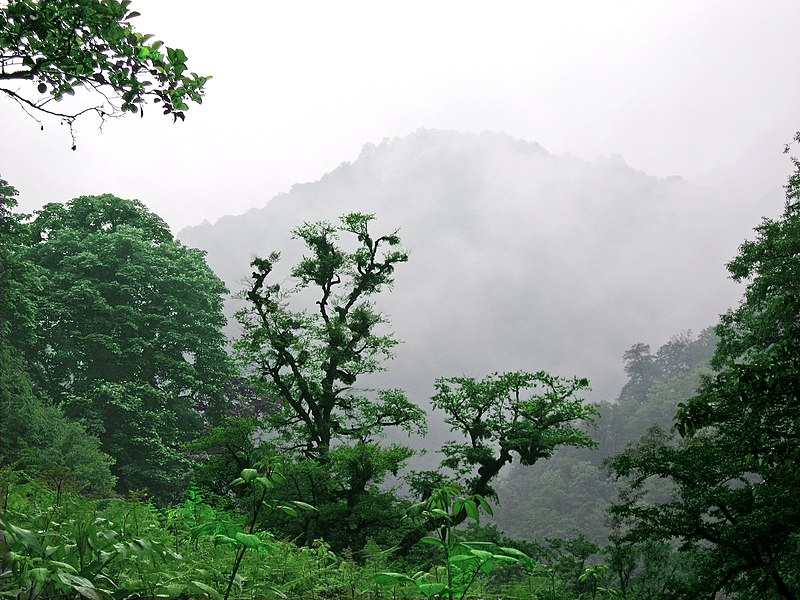
The province is located to the northern of Iran and southwest of the Caspian Sea. Its neighbors are: Caspian Sea and Azerbāijān to the north, Ardabil Province to the West, Qazvin and Zanjan Provinces to the South and Mazandaran Province to the East. Relying on some archeological excavations and hints, Gilin’s origination can be dated back to the period before the last ice age (between 50 and 150 thousand years ago). With an area of 14,711 square km, Gilan province encompasses 0.9% of Iran’s total area and therefore, it ranks 26 among the country’s provinces in terms of total area. Gilān is constituted of three geographical areas: plains, foothills, and mountains. Tālesh, Khalkhāl and Deylaman mountains are the three mountain ranges that encompass the Gilän province. There are more than 40 rivers in Gilān Province and Sefid-Roud River is the most important one. Rainfall is heavis all is heaviest between September and December because the onshore winds from the Siberian High are strongest, but it occurs throughout the year though least abundantly from April to July. Humidity is very high because of the marshy character of the coastal plains and can reach 90 percent in summer for wet bulb temperatures of over 26 °C. That the native inhabitants of Gilan have originating roots in the Caucasus is supported by genetics and language, as Gilaks are genetically closer to ethnic peoples of the Caucasus (such as the Georgians) than they are other ethnic groups in Iran. Their languages shares typologic features with Caucasian languages. The city used to be the origin of the Buyid dynasty. The people of the province had a prominent position during the Sassanid dynasty, so that their political power extended to Mesopotamia. The first recorded encounter between Gilänis and Deylamite warlords and invading Muslim Arab armies was
The province is located to the northern of Iran and southwest of the Caspian Sea. Its neighbors are: Caspian Sea and Azerbāijān to the north, Ardabil Province to the West, Qazvin and Zanjan Provinces to the South and Mazandaran Province to the East. Relying on some archeological excavations and hints, Gilin’s origination can be dated back to the period before the last ice age (between 50 and 150 thousand years ago).RudkhanCastle
With an area of 14,711 square km, Gilan province encompasses 0.9% of Iran’s total area and therefore, it ranks 26 among the country’s provinces in terms of total area. Gilān is constituted of three geographical areas: plains, foothills, and mountains. Tālesh, Khalkhāl and Deylaman mountains are the three mountain ranges that encompass the Gilän province. There are more than 40 rivers in Gilān Province and Sefid-Roud River is the most important one. Rainfall is heavis all is heaviest between September and December because the onshore winds from the Siberian High are strongest, but it occurs throughout the year though least abundantly from April to July. Humidity is very high because of the marshy character of the coastal plains and can reach 90 percent in summer for wet bulb temperatures of over 26 °C.
Ghaleye_Rud_Khan
That the native inhabitants of Gilan have originating roots in the Caucasus is supported by genetics and language, as Gilaks are genetically closer to ethnic peoples of the Caucasus (such as the Georgians) than they are other ethnic groups in Iran. Their languages shares typologic features with Caucasian languages. The city used to be the origin of the Buyid dynasty. The people of the province had a prominent position during the Sassanid dynasty, so that their political power extended to Mesopotamia.
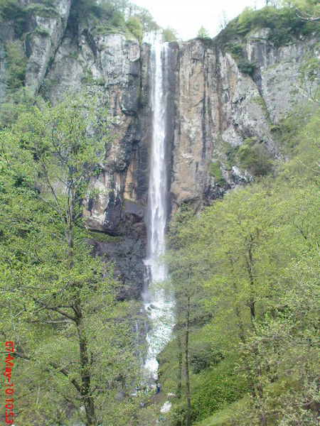
Waterfall_Laton
The first recorded encounter between Gilänis and Deylamite warlords and invading Muslim Arab armies was at the Battle of Jalula in 637 AD. Before the introduction of silk production Gilan was a poor province. There were no permanent trade routes linking Gilan to Persia. But small trade in smoked fish and wood products. It seems that the city of Qazvin was initially a fortress town again marauding bands of Deylamites, another sign that the economy of the province couldn’t support its population. This changed with the introduction of the silk worm in the late Middle Ages.The Safavid emperor, Shal Abbas1ended the rule of Khan Ahmad Khan of Gilan) and annexed the province directly to his empire. From this point onward, rulers of Gilan were appointed b After World War I. Gilan came to be ruled independently of the central goverment of Tehran and concern arose that the province might permanently parate. Before the war, Gilänis had played an imortant role in the Constitutional Revolution of Iran. Sepahdar-e Tonekāboni (Rashti) was a prominent figure in the early years of the revolution and was instrumental in defeating Mohammad Ali Shah Qajar. In the late 1910s, many Gilänis gathered under the leadership of Mirza Kuchik Khan who became the most prominent revolutionary leader in northern Iran in this period. Khan’s movement, known as the Jonbesh-e Jangal (Forest movement of Gilán), had sent an armed brigade to Tehran that helped depose the Qajar ruler Mohammad Ali Shah.
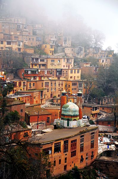
Masouleh_-_panoramio
Five Iranian languages are spoken in Gilan Gilaki,Roudbāri, Täleshi, Tati and Kurdish. All belong to the northwestern branch of Iranian languages. Non-Iranian languages are mainly Azerbaijan i and to a greater extent Georgian, Armenian, Circassian, and some Gypsy (Romany). Three million people speak Gilaki as first or second language.
Asalem_Khalkhal_road_-_Zalzareh_-_panoramio_
Gilan has a strong culinary tradition, from which several dishes have come to be adopted across Iran. This richness derives in part from the climate, which allows for a wide variety of fruit, vegetables and nuts to be grown in the province. Seafood is a particularly strong component of Giläni (and Mazandarani) cuisine. Sturgeon, often smoked or served as kebab, and caviar are delicacies along the whole Caspian littoral.y the Persian Shah.
Beaker
Reference: Cultural Heritage, Handicrafts & Tourism Organization of Iran, Iran Travel guide. Iran: 2018
The Qazvin province is one of the 31 provinces of Iran. It is located in the northwest of Iran, with the city of Qazvin as center. The province was put as part of Region 1 upon the division of the provinces into 5 regions solely for coordination and development purposes on June 22, 2014. 68.05% of Qazvin population lives in cities and 31.95% in villages. The ratio of men to women is 50.7 to 49.3%.99.61% of the province population were Muslims and 0.39% of the rest came from other religions. The literacy rate is over 82%, ranking 7th in Iran. The province covers 15821 km2 between 48-45 to 50-50 east of Greenwich Meridian of longitude and 35-37 to 36-45 north latitude of the equator. The province is bounded on the north by Māzandaran and Gilān, on the west by Hamadān and Zanjān, on the south by Markazi and on the east by Tehrān provinces. The famous mountains of the province are those of Siālān, Shāh Alborz, Khashchal. Sephid-Kouh, Shojä al-din, Alehtareh, Rämand Agh-Dāgh, Kharaghan, Sāridagh, Soltan-Pir, and Siāhkouh, in which Siälän with a height of 4175 m and Shāh Alborz which is 4056 m are the highest, all are part of the central range of Alborz. The lowest point of the province is in Tarom-e Sofla. The climate of the province in the northern parts is cold and snowy in winters and temperate in summers. In the southern parts the climate is mild with comparatively cold winters and warm summers. The annual rainfall of the province varies from 210 mm in the eastern regions to more than 550 mm at northeast elevations. The maximum rainfall is in the northeast slopes of Alamout with more than 550 mm. Qazvin was formerly the capital of the Persian Empire, containing over 2000 architectural
The Qazvin province is one of the 31 provinces of Iran. It is located in the northwest of Iran, with the city of Qazvin as center. The province was put as part of Region 1 upon the division of the provinces into 5 regions solely for coordination and development purposes on June 22, 2014. 68.05% of Qazvin population lives in cities and 31.95% in villages. The ratio of men to women is 50.7 to 49.3%.99.61% of the province population were Muslims and 0.39% of the rest came from other religions. The literacy rate is over 82%, ranking 7th in Iran.
Miremad
The province covers 15821 km2 between 48-45 to 50-50 east of Greenwich Meridian of longitude and 35-37 to 36-45 north latitude of the equator. The province is bounded on the north by Māzandaran and Gilān, on the west by Hamadān and Zanjān, on the south by Markazi and on the east by Tehrān provinces. The famous mountains of the province are those of Siālān, Shāh Alborz, Khashchal. Sephid-Kouh, Shojä al-din, Alehtareh, Rämand Agh-Dāgh, Kharaghan, Sāridagh, Soltan-Pir, and Siāhkouh, in which Siälän with a height of 4175 m and Shāh Alborz which is 4056 m are the highest, all are part of the central range of Alborz. The lowest point of the province is in Tarom-e Sofla. The climate of the province in the northern parts is cold and snowy in winters and temperate in summers. In the southern parts the climate is mild with comparatively cold winters and warm summers. The annual rainfall of the province varies from 210 mm in the eastern regions to more than 550 mm at northeast elevations. The maximum rainfall is in the northeast slopes of Alamout with more than 550 mm.
Avan
Qazvin was formerly the capital of the Persian Empire, containing over 2000 architectural and archeological sites. It is a provincial capital today that has been a cultural center throughout history. Archeological findings in the Qazvin plain reveal the existence of urban agricultural settlements as far back as 7000 BC. The name ‘Qazvin’ or ‘Kasbin’ is derived from Cas, an ancient tribe that lived south of the Caspian Sea millennia ago. The Caspian Sea itself derives its name from the same origin. Qazvin geographically connects Tehran, Isfahan, and the Persian Gulf to the Caspian seacoast and Asia Minor, hence has had strategic location throughout the ages.
Qazvin carpet
Qazvin has been the one of the main centers of tant developments in Iranian history. In the early ors of the Islamic era Qazvin served as a base for e Arab forces. Following destroyed by Genghis Khan, the Safavid monarchs made Qazvin the capital of the Safavid empire in 1548 only to have it moved to Isfahān in 1598. During the Qajar Dynasty and contemporary period, Qazvin has always been one of the most important governmental centers due to its proximity to Tehrān. Abbas Mirza, a Crown Prince and Minister of Commerce, was also the governor of Qazvin.
Barajin, Qazvin, Iran
It is situated close to Alamout, where the famous hasan-e Sabbah, founder of the secret Ismaili cult, dominated. The majority of the people of the province as well I as the city of Qazvin are Persian people and the main language of the people of Qazvin is Persian with the Qazvini accent. Other minority languages include Azeri, Tati, Kurdish, Lori, and Romanian.
Alamut
Reference: Cultural Heritage, Handicrafts & Tourism Organization of Iran, Iran Travel guide. Iran: 2018
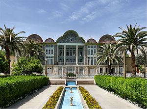
Fārs Province also known as Pars or Persia in historical context, is one of the thirty-one provinces of Iran and known as the cultural capital of the Iran Era administrative center is Shiraz. It has an area of 122,400 km2. The etymology of the word Persian found in many ancient names associated with Iran, is derived from the historical importance of this region. Fars Province is the original homeland of the Persian people. There are three distinct climatic regions in the Fārs Province. First, the mountainous area of the north and northwest with moderate cold winters and mild summers. Secondly, the central regions, with relatively rainy mild winters, and hot dry summers. The third region located in the south and southeast, has cold winters with hot summers. The ancient Persians were present in the region from about the 10″century BC, and became the rulers of the largest empire the world had yet seen under the Achaemenid dynasty which was established in the mid-6th century BC, at its peak stretching from Thrace-Macedonia, Bulgaria-Paeonia and Eastern Europe proper in the west, to the Indus Valley in far east. The ruins of Persepolis and Pasargadae, two of the four capitals of the Achaemenid Empire, are located in Fars. The Achaemenid Empire was defeated by Alexander the Great in 333 BC, incorporating most of their vast empire. The Seleucid Empire was subsequently defeated by the Parthians in 238 BC. By 205 BC, Antiochus III extended his authority into Persis and ceased to be an independent state. Babak was the ruler of a small town called Kheir. Babak’s efforts in gaining local power at the time escaped the attention of Artabanus IV, the Arsacid Emperor of the time. Babak and his eldest son Shäpour I managed to expand their power over all of Persis. Ardashir
Fārs Province also known as Pars or Persia in historical context, is one of the thirty-one provinces of Iran and known as the cultural capital of the Iran Era administrative center is Shiraz. It has an area of 122,400 km2. The etymology of the word Persian found in many ancient names associated with Iran, is derived from the historical importance of this region. Fars Province is the original homeland of the Persian people.
Bagh-e_Eram
There are three distinct climatic regions in the Fārs Province. First, the mountainous area of the north and northwest with moderate cold winters and mild summers. Secondly, the central regions, with relatively rainy mild winters, and hot dry summers. The third region located in the south and southeast, has cold winters with hot summers.
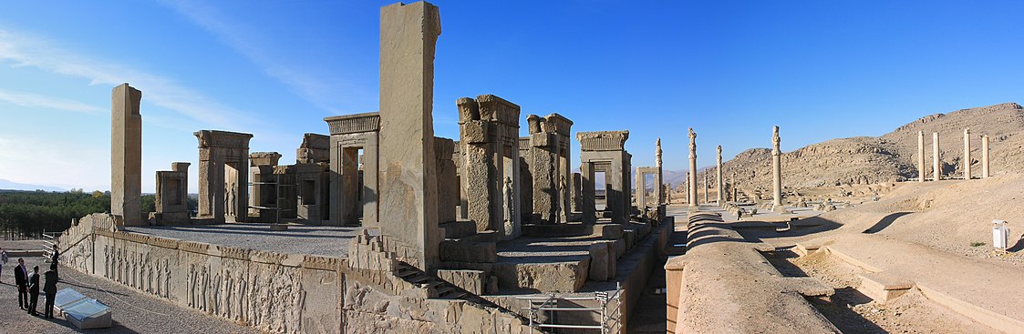
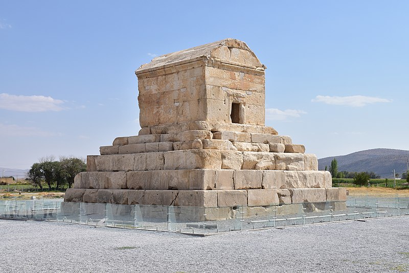
The ancient Persians were present in the region from about the 10″century BC, and became the rulers of the largest empire the world had yet seen under the Achaemenid dynasty which was established in the mid-6th century BC, at its peak stretching from Thrace-Macedonia, Bulgaria-Paeonia and Eastern Europe proper in the west, to the Indus Valley in far east. The ruins of Persepolis and Pasargadae, two of the four capitals of the Achaemenid Empire, are located in Fars.
Persepolis
The Achaemenid Empire was defeated by Alexander the Great in 333 BC, incorporating most of their vast empire. The Seleucid Empire was subsequently defeated by the Parthians in 238 BC. By 205 BC, Antiochus III extended his authority into Persis and ceased to be an independent state. Babak was the ruler of a small town called Kheir. Babak’s efforts in gaining local power at the time escaped the attention of Artabanus IV, the Arsacid Emperor of the time. Babak and his eldest son Shäpour I managed to expand their power over all of Persis. Ardashir was crowned in 226 at Ctesiphon as the sole ruler of Persia, bringing the 400-year-old Parthian Empire to an end, and starting the virtually equally long rule of the Sassanian Empire, over an even larger territory, once again making Persia a leading power in the world, only this time along with its arch-rival and successor to Persia’s earlier opponents (the Roman Republic and the Roman Empire; the Byzantine Empire). The Sassanids ruled for 425 years, until the Muslim armies conquered the empire. Afterwards, the Persians started to convert to Islam, this making it much easier for the new Muslim empire to continue the expansion of Islam. Persis then passed hand to hand through numerous dynasties, leaving behind numerous historical and ancient monuments, each of which has its own values as a world heritage, reflecting the history of the nrovince Iran and West Asia. The ruins of Bishapour, Persepolis, and Firouz-Abad are all reminders of this. Arab invaders brought about a decline of Zoroastrian rule and made Islam ascendant from the century.
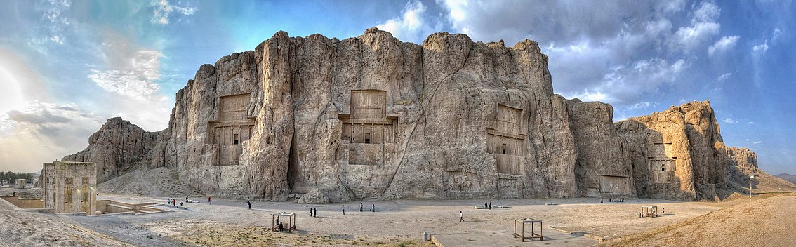
Naghshe_Rostam_ZPan
Färs province is one of the provinces that has the highest nomadic population. The culture of the Persian people in general is divided into celebrations, music, clothing and food. In the music section the Aashiqs, Qashqai, Changyan and Sarebanran are existing. The Aashiq music is ancient and extensive, mixed with folkloric poetry.
In Färs province, there are different ethnic groups including Fars, Lor, Turkish Qashqai, Tajik, Arab Khamseh, Kurd and Lak. One of the most important nomadic regions of Iran is Färs province, with a population of 137, 717 people, about 32 percent of the Iran nomadic population and 3 percent of the province’s population. In addition to Qashqai, Baseri, Baharloo, Mohseni, as well as smaller tribes, continue their nomadic life in Fars.
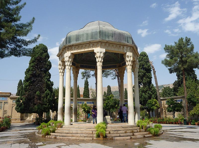
Háfezova_hrobka
Fars people’s clothing is very diverse due to cultural diversity, which can be referred to as Qaba (Arkhaleq). shawl and Chaqeh(coat), which is the clothing of the nomadic tribes of Kouhmareh Sarakhas. The official language of the Färs province is, Farsi. Before Islam, the Persian language was the Middle Persian, which is nowadays changed into Persian and is used among most of the people of the province and Baseri tribe.
Pasargad_Tomb_Cyrus3
Reference: Cultural Heritage, Handicrafts & Tourism Organization of Iran, Iran Travel guide. Iran: 2018
East Azarbaijan Province is one of the 31 provinces of Iran. It is located in Iranian Āzerbāijān , bordering with Armenia, Republic of Āzerbăijān , Ardabil, West Āzerbāijān , and Zanjān Provinces. The capital of East Āzerbāijān is Tabriz. The province covers an area of approximately 47,830 km2, with the historical city of Tabriz as the most important city of Tabriz as the most important city of this province, culturally, politically, and commercially. The province has common borders with the current Republics of Azerbaijan, Armenia and Nakhchivan. A fine network of roads and railways connect East Āzerbaijan to other parts of Iran and neighboring countries. The highest peak of East Āzerbāijān is Sahand Mountain at 3,722 m elevation, lying south of Tabriz. East Azerbāijān enjoys a cool, dry climate, being in the main mountainous region. But the gentle breezes off the Caspian Sea have some influence on the climate of the low areas. Temperatures run up to 8.9 °C in Tabriz, and 20 °C in Maraqeh, in the winter drops to 10 to 15 °C at least. The ideal seasons to visit this province are spring and summer. East Āzerbāijān is one of the most Ancient territories in Iran. During the reign of Alexander of Macedon in Iran (331 BCE), a warrior known as Attorpat led a revolt, then it was a territory of the Medes, and thereafter called Attorpatkan. Islamic researchers proclaim that the birth of the prophet Zoroaster was in this area, near Lake Orumieh (Chichesht), Konzak City. The most outstanding features of East Azarbayjan culture is language of Azari/Azerice, and folklore of this region. Apart from this, the province also boasts numerous learned scholars, Gnostics and several national poets such as contemporary poet Ostad Mohammad Hossein Shahriyar. The current leader of Iran, Ayatollah Ali Khamenei is originally
East Azarbaijan Province is one of the 31 provinces of Iran. It is located in Iranian Āzerbāijān , bordering with Armenia, Republic of Āzerbăijān , Ardabil, West Āzerbāijān , and Zanjān Provinces. The capital of East Āzerbāijān is Tabriz. The province covers an area of approximately 47,830 km2, with the historical city of Tabriz as the most important city of Tabriz as the most important city of this province, culturally, politically, and commercially.
The province has common borders with the current Republics of Azerbaijan, Armenia and Nakhchivan. A fine network of roads and railways connect East Āzerbaijan to other parts of Iran and neighboring countries. The highest peak of East Āzerbāijān is Sahand Mountain at 3,722 m elevation, lying south of Tabriz. East Azerbāijān enjoys a cool, dry climate, being in the main mountainous region. But the gentle breezes off the Caspian Sea have some influence on the climate of the low areas.
Ammand_Dam
Temperatures run up to 8.9 °C in Tabriz, and 20 °C in Maraqeh, in the winter drops to 10 to 15 °C at least. The ideal seasons to visit this province are spring and summer. East Āzerbāijān is one of the most Ancient territories in Iran. During the reign of Alexander of Macedon in Iran (331 BCE), a warrior known as Attorpat led a revolt, then it was a territory of the Medes, and thereafter called Attorpatkan. Islamic researchers proclaim that the birth of the prophet Zoroaster was in this area, near Lake Orumieh (Chichesht), Konzak City. The most outstanding features of East Azarbayjan culture is language of Azari/Azerice, and folklore of this region.
Apart from this, the province also boasts numerous learned scholars, Gnostics and several national poets such as contemporary poet Ostad Mohammad Hossein Shahriyar.
Pol-e_Dokhtar_or_Bridge_of_the_Daughter_in_Iran
The current leader of Iran, Ayatollah Ali Khamenei is originally from this region. Iran’s Cultural Heritage Organization has registered 936 sites of historical significance in the province. Some are contemporary, and some are from the antiquity of ancient Persia. “Zahak Citadel”, for example, is the name of an ancient ruin in East Azerbāijān, which according to various experts, was inhabited from the second millennium BC until the Timurid era. East Āzerbāijān enjoys a rich compendium of Azeri traditions.
Azerbaijani_Afshan_rug
Many local dances and folk songs continue to survive among the various peoples of the province. As a longstanding province of Iran, Azerbāijān is mentioned favorably on many occasions in Persian literature by greatest authors and poets.
Reference: Cultural Heritage, Handicrafts & Tourism Organization of Iran, Iran Travel guide. Iran: 2018
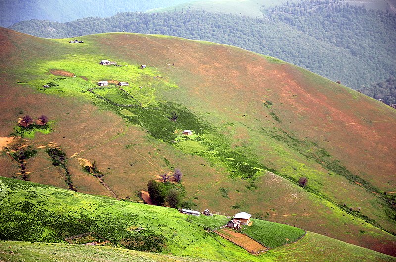
Chāhār-Mahāl & Bakhtiāri Province is one of the 31 provinces of Iran. It lies in the southwestern part of the country. Its capital is Shahr-e Kord. The province has an area of 16,332 square km. The province area consisted mainly of highlands, and most of its area has more than 2,000 meters’ altitude. This turns the province to a cold region, especially in the winter. Snow fall in this province starts usually from the middle of the autumn, and continues till the first month of the spring. But there are some lowlands in which temperature rise in summer to more than 40 degree, and rain fall average is consequently lower. The cold season usually starts from the mid-autumn and lasts 45 months, in which January and February are the coldest. The general average temperature is +10.3C, while the higher average is +35.2 C, and the lower average is 15.6 C degree. The annual rain fall average is 426 millimeters and the frost days’ average is recorded at 127. The history of the province of Chāhār-Mal & Bakhtiari is mixed with the Bakhtia tribe. There is a branch of the “Lure Bozor which means the Grand Lur. The Bakhtiari tribc itself is divided into two main branches which are called “Haft Lang” and “Chahar Lang”. The Bakhtiari tribe has two different, summer and winter territories. The summer territory of the Chahar Lang branch is the north, while the summer territory of the Haft Lang is the south. Historically, the Bakhtiari territory was sometimes under the Fārs state, and some other times under the Khouzestān’s. The nomad living style of Bakhtiaris, did not left many historical buildings or physical elements. But the beautiful nature of the region and the many ecotourism potentials of the province are significant and unique, which attracts viewers.
Chāhār-Mahāl & Bakhtiāri Province is one of the 31 provinces of Iran. It lies in the southwestern part of the country. Its capital is Shahr-e Kord. The province has an area of 16,332 square km.
The province area consisted mainly of highlands, and most of its area has more than 2,000 meters’ altitude. This turns the province to a cold region, especially in the winter. Snow fall in this province starts usually from the middle of the autumn, and continues till the first month of the spring. But there are some lowlands in which temperature rise in summer to more than 40 degree, and rain fall average is consequently lower. The cold season usually starts from the mid-autumn and lasts 45 months, in which January and February are the coldest. The general average temperature is +10.3C, while the higher average is +35.2 C, and the lower average is 15.6 C degree. The annual rain fall average is 426 millimeters and the frost days’ average is recorded at 127.
The central mountain of the world mountain range between Hafshjan
The history of the province of Chāhār-Mal & Bakhtiari is mixed with the Bakhtia tribe. There is a branch of the “Lure Bozor which means the Grand Lur. The Bakhtiari tribc itself is divided into two main branches which are called “Haft Lang” and “Chahar Lang”. The Bakhtiari tribe has two different, summer and winter territories. The summer territory of the Chahar Lang branch is the north, while the summer territory of the Haft Lang is the south. Historically, the Bakhtiari territory was sometimes under the Fārs state, and some other times under the Khouzestān’s.
The nomad living style of Bakhtiaris, did not left many historical buildings or physical elements. But the beautiful nature of the region and the many ecotourism potentials of the province are significant and unique, which attracts viewers.
The central mountain of the world mountain range between HafshjanPromenade of the
The history of the province is tied to that of the Bakhtiari tribe. The Bakhtiari tribe is the main speakers of Lurish language. As the name of the province comes with the combining grammatical feature of ’-o-’ which is Persian for ‘and; the other group of peoples in this ancient province are the Chahar Mahal’s. This people and Lurs live side by side and share almost simlar customs.
They have a history of having a simple living and being capable people who are determined, effective warriors and fighters whenever circumstances made it necessary. They have gained such a reputation as being excellent, if not the best, horsemen in Iran. The people of this province has Pahlevani wrestling/combat style of the deep rooted traditional Zourkhaneh, which exists everywhere in all provinces, also they have their own style. The style is called Jangi (Jang means War and hence Jangi or “war-like”). The province has various unique traditions and rituals relative to the tribal’ lifestyles. Special forms of music, dance, and clothing are noteworthy.
Reference:
Cultural Heritage, Handicrafts & Tourism Organization of Iran, Iran Travel guide. Iran: 2018
Ardabil Province is one of the 31-provinces of Iran. It is in the northwest of the country, bordering the Republic of Azarbayjan and the provinces of East Azarbayjan, Zanjan, and Gilan. Its center is the city of Ardabil. The province was established in 1993 from the eastern part of East Azarbayjan. Many tourists come to the region for its cool climate during the hot summer months. The winters are bitterly cold. Its famous natural region is the Sabalan Mountains. The province is considered the coldest province and many large parts of the province are green and forested. The natural features of the province of Ardabil are mentioned in the Avesta, according to which Zoroaster was born by the river Aras and wrote his book in the Sabalan Mountains. During the Islamic conquest on Iran, Ardabil was the largest city in Azarbayjan, and remained so until the Mongol invasion period. Shah Ismail1 started his campaign to nationalize Iran’s government and land from here, but consequently announced Tabriz as his capital in 1500 CE. Yet Ardabil remained an important city both politically and economically until modern times. Ardabil is the sanctuary of Sheikh Safi ad-Adin, eponym of the Safavid Dynasty. It has many hot springs and natural landscapes which attract tourists. In the Safavid period, Ardabil was the most important city of Iran both politically and economically. The city of Ardabil located on the trade crossroads between Europe and the East, played a critical role in the safety of the Silk Road. The province is still strategically important with respect to tourism and trade. The city of Ardabil now is one of the most important cities of the province and Iran for its many historical monuments, specially the Safavid family’s mausoleums and tombs, its location near many thermal springs with therapeutic
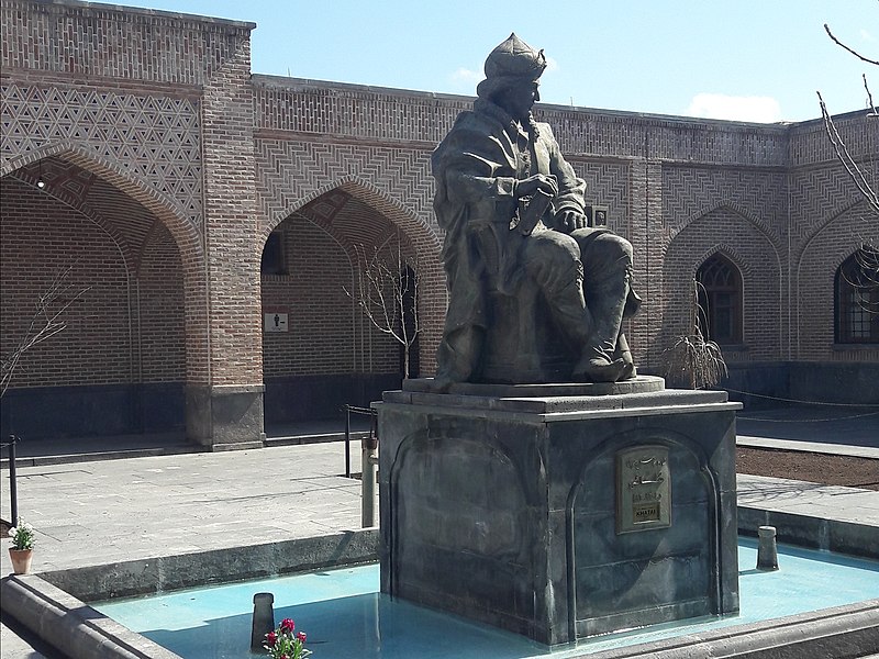
Ardabil Province is one of the 31-provinces of Iran. It is in the northwest of the country, bordering the Republic of Azarbayjan and the provinces of East Azarbayjan, Zanjan, and Gilan. Its center is the city of Ardabil. The province was established in 1993 from the eastern part of East Azarbayjan.
Many tourists come to the region for its cool climate during the hot summer months. The winters are bitterly cold. Its famous natural region is the Sabalan Mountains. The province is considered the coldest province and many large parts of the province are green and forested.
Shah Ismail I Statue
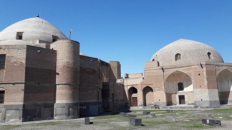
The natural features of the province of Ardabil are mentioned in the Avesta, according to which Zoroaster was born by the river Aras and wrote his book in the Sabalan Mountains. During the Islamic conquest on Iran, Ardabil was the largest city in Azarbayjan, and remained so until the Mongol invasion period. Shah Ismail1 started his campaign to nationalize Iran’s government and land from here, but consequently announced Tabriz as his capital in 1500 CE. Yet Ardabil remained an important city both politically and economically until modern times.
Shahidgah
Ardabil is the sanctuary of Sheikh Safi ad-Adin, eponym of the Safavid Dynasty. It has many hot springs and natural landscapes which attract tourists. In the Safavid period, Ardabil was the most important city of Iran both politically and economically. The city of Ardabil located on the trade crossroads between Europe and the East, played a critical role in the safety of the Silk Road. The province is still strategically important with respect to tourism and trade. The city of Ardabil now is one of the most important cities of the province and Iran for its many historical monuments, specially the Safavid family’s mausoleums and tombs, its location near many thermal springs with therapeutic virtues, and location on the main access road to the Republic of Azarbayjan. These have turned the city to a tourism center, which is visited by thousands of tourists every year.
Reference:
Cultural Heritage, Handicrafts & Tourism Organization of Iran, Iran Travel guide. Iran: 2018